
Where beauty, play and fragile meet – 02.06-08.16
Extra points I give to islands I can go around in n steps (others being Potipot and Mantigue) so it was a pleasant surprise when KALANGGAMAN turned out to be one even when what initially pulled me in is its promise of calm water and its interesting shape, hence its name.
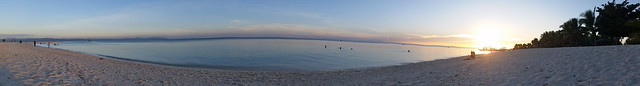
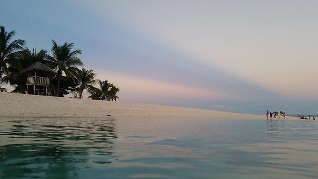
Water turned out an interesting range of calm to with soft waves, not to mention amazingly clear against backdrop of skies with such play of colors during sunrise and sundown and starry black in between.
I find it cheesy to often use the word beautiful but this island is precisely that. What adds to its charm even is how it seems fragile as felt in how harsh the wind can be in that place at certain times of day. Apparently, there is so much more than its shape.

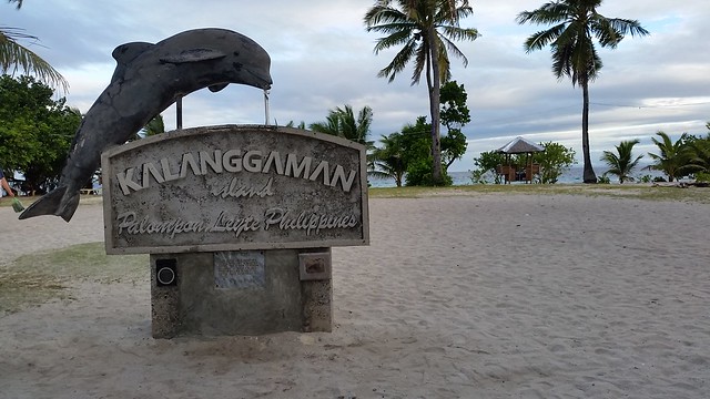
Kalanggaman Island
(name in local dialect means “bird” as it is shaped like one with its two end-to-end sandbars resembling that of a bird’s wings)
After impulsively booking a flight to Leyte, I had to do some research on the best beaches in the province. A lot came into discovery so this island was a winner against Canigao and Quatro Islas. It was gaining popularity at that time with positive reviews and amazing pictures that I thought to self it had to be the choice – mainly because I wanted to be there before it gets too much a favorite among visitors.
As in most good beaches, it takes some travel time to get to Kalanggaman. In my case, I spent my entire morning getting there. Having reached Palompon a little before noon, I was at the island around one in the afternoon after hitching with a group. (Details on the hows at the end of this entry).

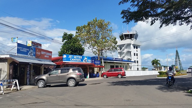
Upon arrival at the domestic airport
###

Looking weird like an orange turtle :p
(And I couldn’t remember how I managed to take this selfie on a boat full of strangers. And yes, I cannot not wear vests whenever I ride boats)
###
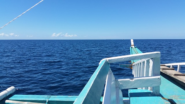
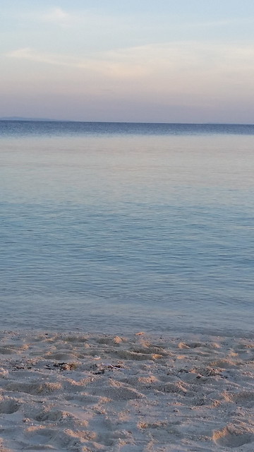
Many shades of blue
###
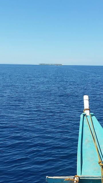
Seeing it soon
###
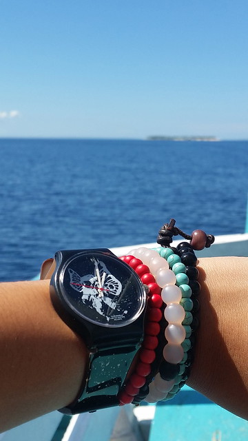
Are we there yet?
###
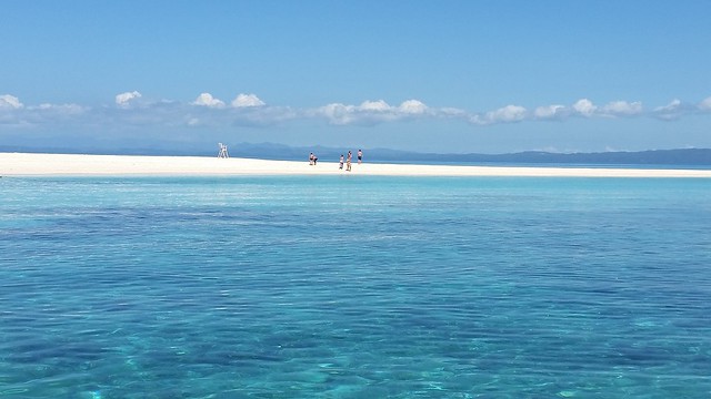
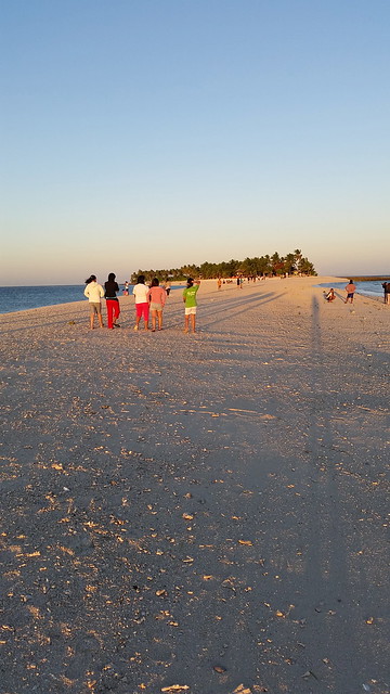
K. Wow.
###
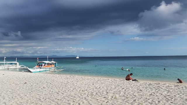
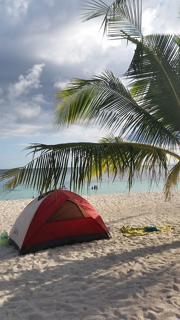
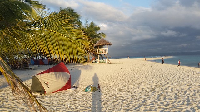
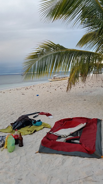
It was around a quarter past 1 when I arrived in the island and the first thing I had to do was find a place for my tent. Finding some shade was easy as there are just the right amount of trees concentrated at the center of the island. I immediately had my eye on this spot with the view of the sea and the skies. Funnily though, this first spot I chose sort of smelled like pee – so hello, welcome booboo. Of course, I had to move – but someplace not so far because I wanted to keep the view of the sandbar from where I initially wanted to set camp.

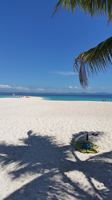
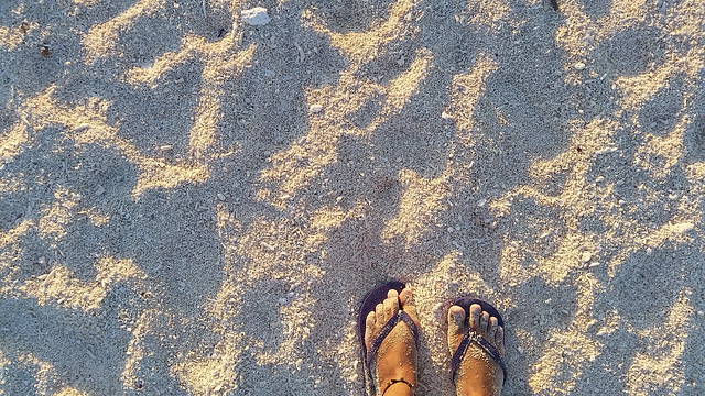
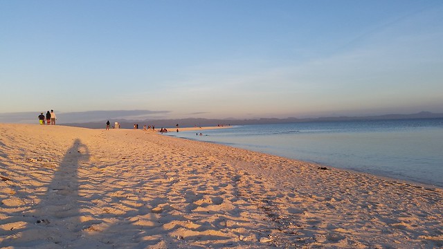
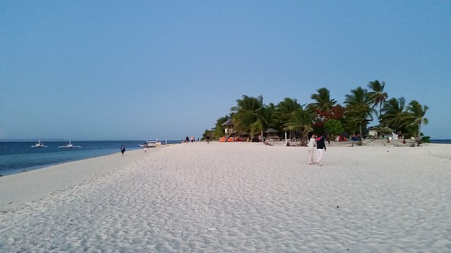
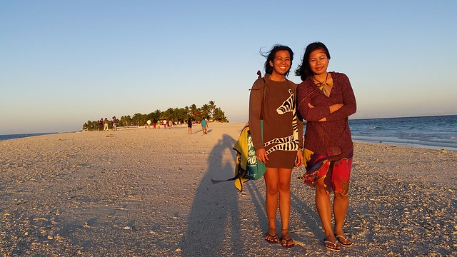
While I came in solo, I was expecting friends to come later that afternoon. In between that was my usual when in beaches – beer, being lazy, doing my version of swimming which was a perfect match to this place. The usual running in barefoot in the sand was just not as much because the sand here can be harsh – mostly of crushed corals and tiny shells.
My friends arrived around mid-afternoon but we each respected our individual ‘trips’ – I was on repeat with the usual while they did their swimming (real swimming) while taking lovely professional-traveler Instagram photos. Time went fast and it was already sunset when we got together.
Colors in contrast during sunset
I have seen several sunsets and each is different for every place and what I love about one in Kalanggaman is its obvious contrast. On the side of the island where the sun sets was this too much orange while on the other end, pastel colors defined the skies.
![]()
Not captured in these photos but it was my intent to show that contrast
###
On this side (on the right when facing the sea) is this orange –


– but from the same spot and on the left are these –
When it was dark, we huddled by our tents and over music had dinner. All these normal people stuff were care of my friend because if it was just me, I usually just drink beer and eat food from easy-open cans.
###
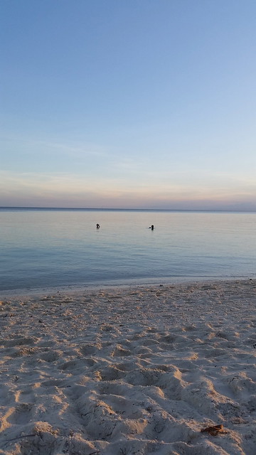
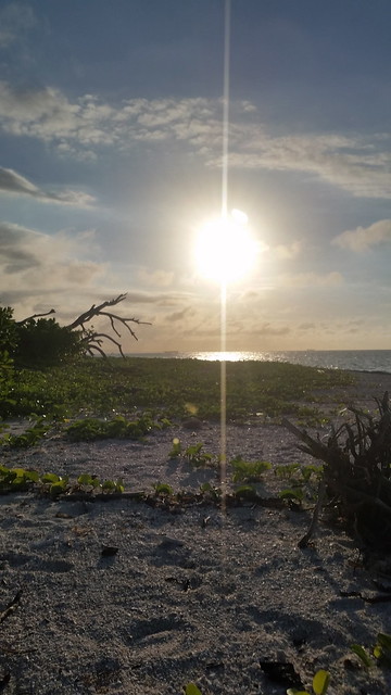
Colors in contrast again during sunrise
Just in reverse, that playfulness with color happened the following morning


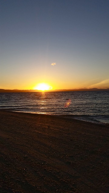
Obviously, it was windy and cold
###
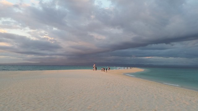
Second day a repeat except I did that walk-around project
We essentially did the same things on the second day. When they had to leave a little before lunch, I had more time to self to do this little ‘project’ of walking around islands and counting steps. As I assumed that the island was bigger than the previous ones (and boy with the number of steps, I was right), I did it on the latter part of the afternoon (around 4:30PM) when it was less hot.
Having experienced the harsh wind the previous night from where we set up camp, I also had to move my tent.
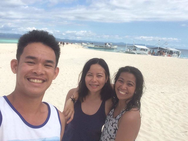
The party before they left that day
###
Number of steps it took me is double that of Potipot and Mantigue so I had more stops than usual, recording the number on my memo each time. (Yes, there was some Math involved at the end).
During my walk, I had time to see the less popular part of the island. Oddly though, I was not able to see the other sandbar. I just kept on walking and before I knew it, I could see my tent. (I have done some research after the trip and learned that during typhoon Haiyan / Yolanda, the island was badly hit which caused changes on one of its sandbars. I could not be sure whether it had to do why I missed it but darn, this just makes me want to come back).
And after circling the island, I came ‘home’ to this
###
On day three, against all my happiness, I had to leave. I deliberately woke up early and made the most of what is little left of my morning there.
By 7AM, I was out
###
Back at the Tourism Office
###
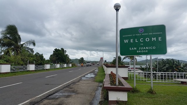
San Juanico Bridge
(longest bridge in the Philippines that connects Samar and Leyte)
Just like my first day, I spent my morning traveling. By early afternoon, I was at a terminal where I took a van to Basay because I have been meaning to see SAN JUANICO BRIDGE as a quick side trip.
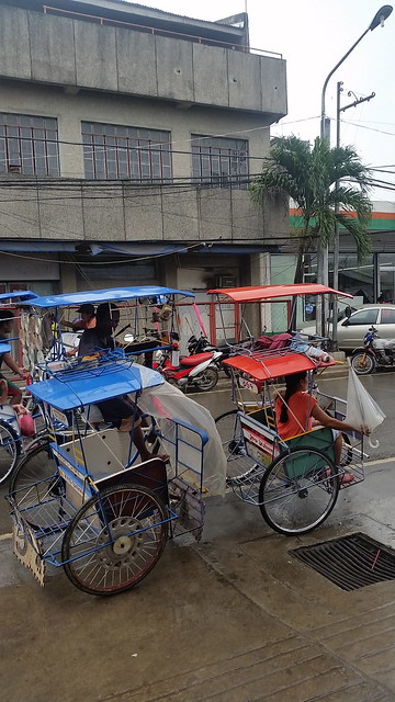
These unique vehicles spotted at the terminal
###
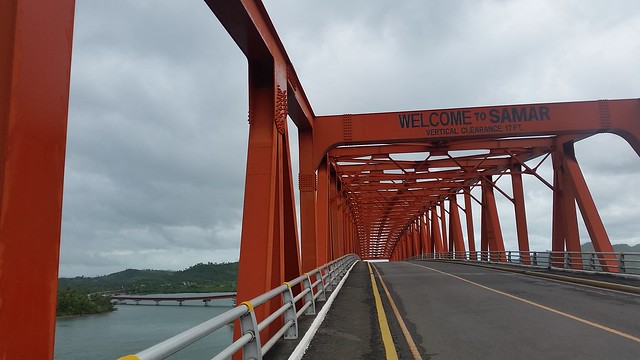
Should I have more time I could have walked all the way but since I did not have that luxury then, I just had to see the Welcome sign at the other end then I went back. On my way, I saw a bunch of kids swimming who when saw me waved at me and asked for more pictures.

Clueless as to how I can go back, I waited for some divine intervention on the side of the road. A kind man offered a ride (I guess it was too obvious that I am a lost tourist with my backpack and all) but I refused because that kindness may be a mere impression). I waited and fortunately, the universe sent me a sign on what to do. I flagged a tricycle and asked to be taken to downtown then from there, I was on all “bahala na” (whatever goes) mode.
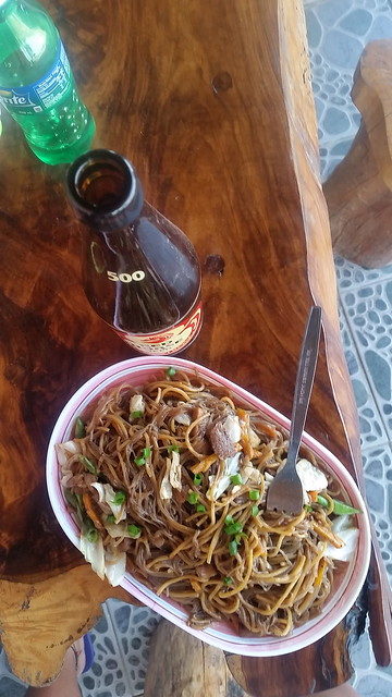
It worked I think because I arrived at the airport via public commute safely and with time to spare I even managed to score one last beer and pancit bam-i (pansit Bisaya) before checking in. I even met this little boy who according to the lady at the eatery lost his parents during Yolanda and found his way to them.
Hmm. I wonder what that generic BEER is
###

I wonder whether they have pried chicken
###
###
How to get there and other practical details
1. From Manila, Philippines, there are daily flights to Tacloban
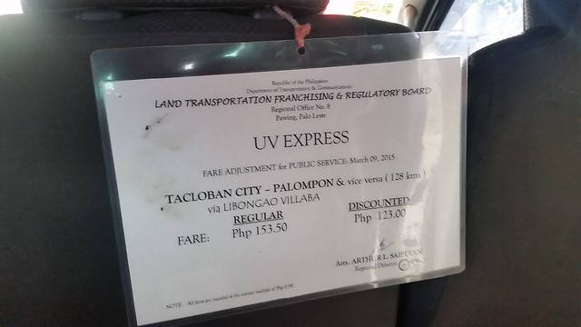
2. From Tacloban, you need to reach Palompon
From the airport, you may take tricycle to take you to the terminal for 150 pesos. This is what I initially did going to Palompon. When I was back though, I realized there are jeepneys near the line of eateries outside the airport which I suppose can take you to several points in town.
From the terminal, there are vans going to Palompon. Travel time is at around 3-4 hours and fee at 150 pesos.
Note that there are other routes but I will just share details of what I have tried. I have read that there is one via Ormoc but it might take longer.
3. Register and arrange your boat ride at the tourism office near Palompon Liberty Park
I came in solo and had no boat arrangements so it was the office that assigned me to a big group I can hitch with (They seem to have had their reservation so maybe there is a number to call to pre-arrange)
Cost of the boat is at 3,000 pesos minimum good for 15 people.
Travel time takes 40 minutes to an hour.
To go back :
From Tacloban, there are jeepneys near a Mcdonalds at the pier that you can take to go to the airport.
OTHER PRACTICAL DETAILS
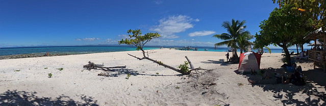
1. There are no resorts in the island and that is what makes it perfect for camping
For those who prefer more comfort, there are huts and cottages for rent.
2. The sand may look fine in photos but it is mainly of tiny shells /crushed corals.
Best to bring comfortable slippers or aqua shoes. If you plan to sleep on sand, bring thick blankets or sleeping bags.
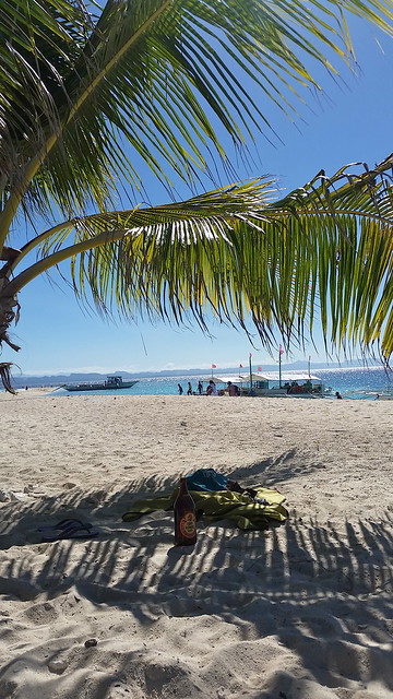
3. Bring your own food and drinks
There are no restaurants in the island so I suggest to buy food while still in Palompon.
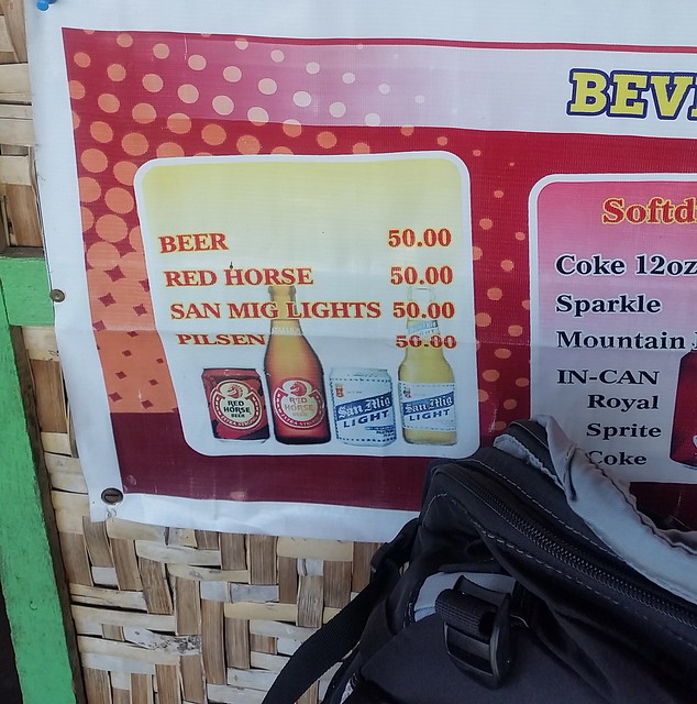
Tourism office is within walking distance from the public market where they sells all kinds of food from roasted chicken / liempo, home-cooked meals, canned goods etc. Beer typically sold in cases except in eateries where bottles in 500 and 1L are available.
Beverages are available in the island but as expected, these are more expensive at 100 pesos per 1L serving.
4. There is no electricity in the island
Make sure your gadgets and power banks are charged well. No need to worry at night though because there are installed lamp posts.
5. Shower and toilet stalls are available but expect just basic clean.
6. There are fees to go and/or stay overnight in the island.
Details can be found here.
ABOUT THE AUTHOR
Kristina Correa (or more known to almost all people in her life as Teng) is based on the city of Manila in the Philippines and whenever she can, cools off with routine and gets her doses of happy someplace else. She doesn’t mean to inform and help plan (as obvious with her laziness with details) but hopes her stories and photos can inspire you to create your own.

I thought Kalanggaman Island have lots of ants.. Hahaha I was wrong. Good thing I have read about its meaning in their local dialect. 🙂 Great pictures.
Haha that was a funny impression but it made me think. Hmm, as in most secluded beaches, yes I remember it did have areas where there are ants. But that’s a tiny negative compared to how beautiful place is when I was there. Go visit soon!
yes I will visit soon.. 🙂 It is already part of my bucket list.. 🙂